 CabBuddy
Home › Useful info › CoPilot vs CabBuddy
CoPilot vs CabBuddy: my lorry sat nav sent me down a road that isn't there
By Zydrunas Likas, Class 1 driver and founder of CabBuddy™ · 11 November 2026
Today I drove a lorry from Northampton to a distribution centre near Bristol. Before I set off, I checked the route in CoPilot and in CabBuddy. They did not agree, and only one of them was right.
Two route checks, one trip
Before setting off, I put the address into CoPilot, a well-known HGV sat nav. Then, out of habit, I checked the same trip in CabBuddy, which plans lorry routes using TomTom truck routing.
The two routes were not the same.
A low bridge on the way
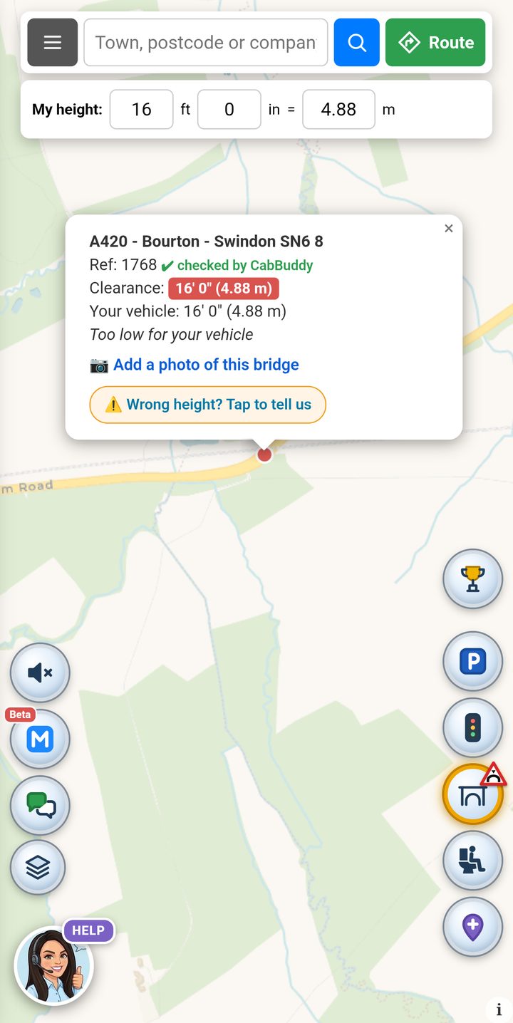
On the A420 at Bourton, near Swindon, there is a low bridge with a clearance of 16' 0" (4.88 m). My lorry today was 14' 9" (4.50 m), so I went under it with room to spare.
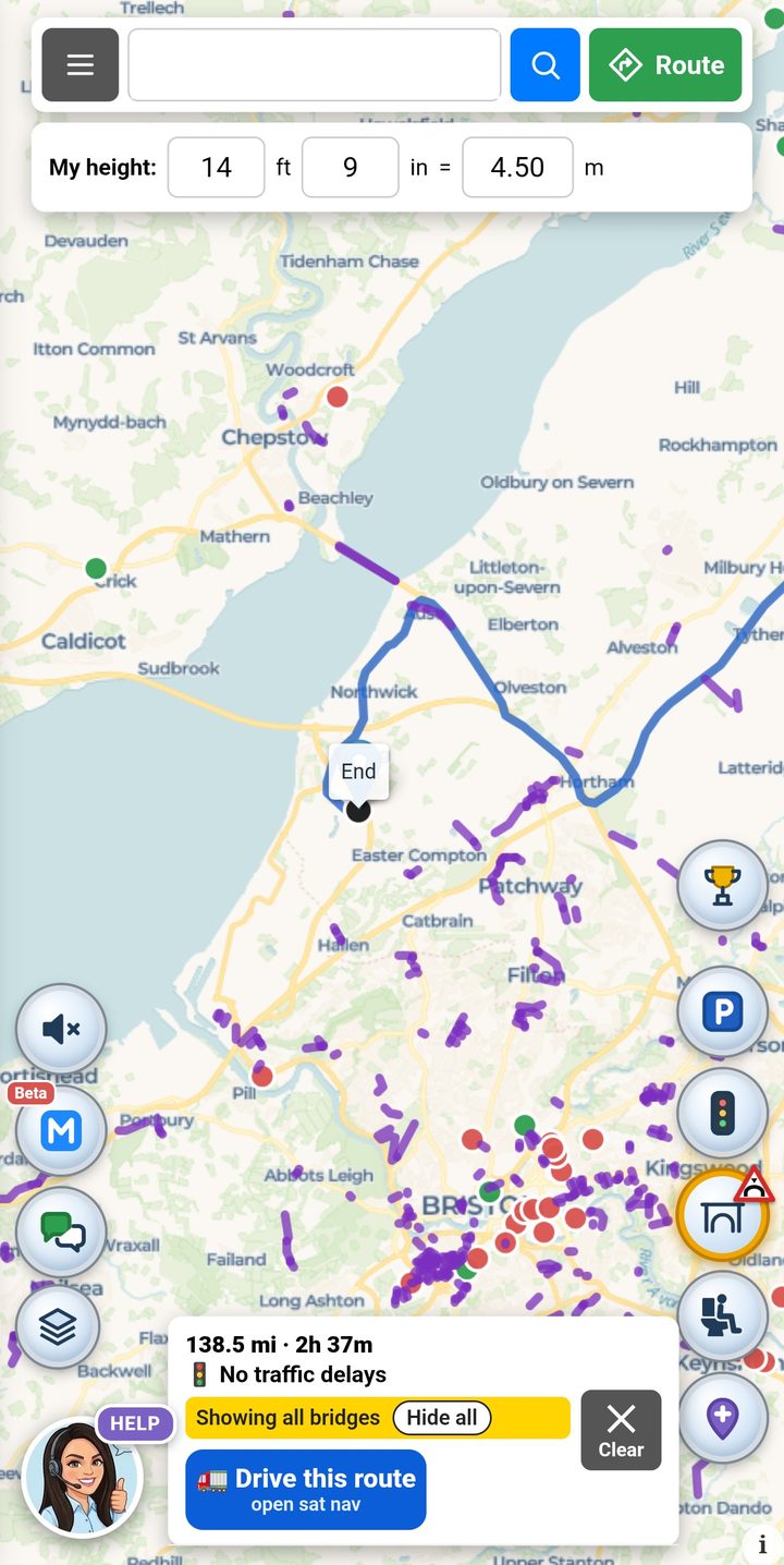
But on a different day, with a different trailer, that bridge could be a problem. Plenty of trailers run at 16 ft or more. In the picture I have set CabBuddy to 16' 0" to show what you would see: the bridge turns red and says it is too low. When your height is the same as the bridge, it is too low. There is no room for bounce, a raised fifth wheel or new road surface.
What CoPilot did
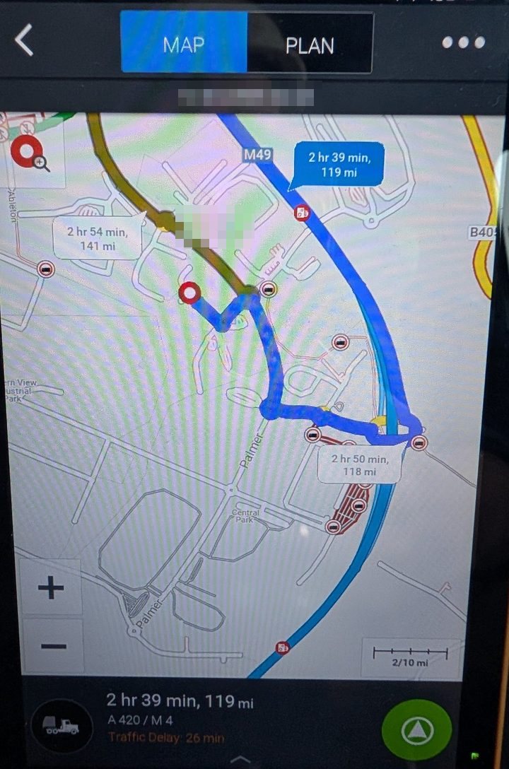
Near the end of the trip, close to the M49, CoPilot wanted to send me off a roundabout and down a slip road. The problem is that this slip road is closed, and has been for a long time. In real life there is no road there to drive on.
If you follow the screen without looking, that is how you end up stuck, turning a 44-tonne lorry round where there is no room, or late for your slot.
What CabBuddy did
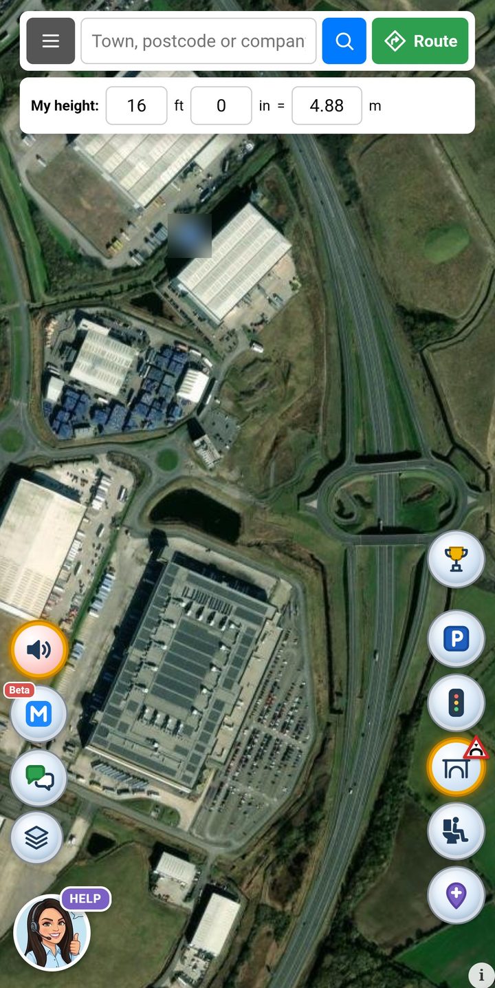
The CabBuddy route did not use the closed slip road at all. It went the proper way in, and it was right. CabBuddy plans its lorry routes with TomTom truck routing.
Why CabBuddy uses TomTom
I have been driving for years, and I have used TomTom sat navs for thirteen of them. In all that time they have never let me down like this. So when I built CabBuddy, I chose TomTom to plan the routes. Not because someone paid me to, but because it is the one I trust from my own driving.
This is one trip, not the whole story
To be fair, this was one trip. Every sat nav gets things wrong sometimes, and maps go out of date. This is just what happened to me today.
But it shows something every driver already knows: never trust one screen blindly.
- Check your route a second way, in a different sat nav or on a map.
- Look at the last few miles closely. That is where wrong turns and closed roads catch you out.
- Set your real height, with the trailer and load, in every sat nav you use.
- On the road, trust the signs and what you can see over the screen.
Check your route before you go
CabBuddy is free for lorry drivers, made by a lorry driver, and needs no sign-up. You can check a truck route, see low bridges like the one at Bourton and weight limits on the map, and turn on spoken bridge alerts.
Check your truck route free Open the low bridge mapMore from Useful info: How to avoid a bridge strike: 7 checks before you set off · Why an old Google map can be dangerous
This is one driver's experience on one trip, not a test of either product. CoPilot and TomTom are trade marks of their owners. CabBuddy uses TomTom's routing service but is not sponsored by TomTom or CoPilot. Always follow road signs.